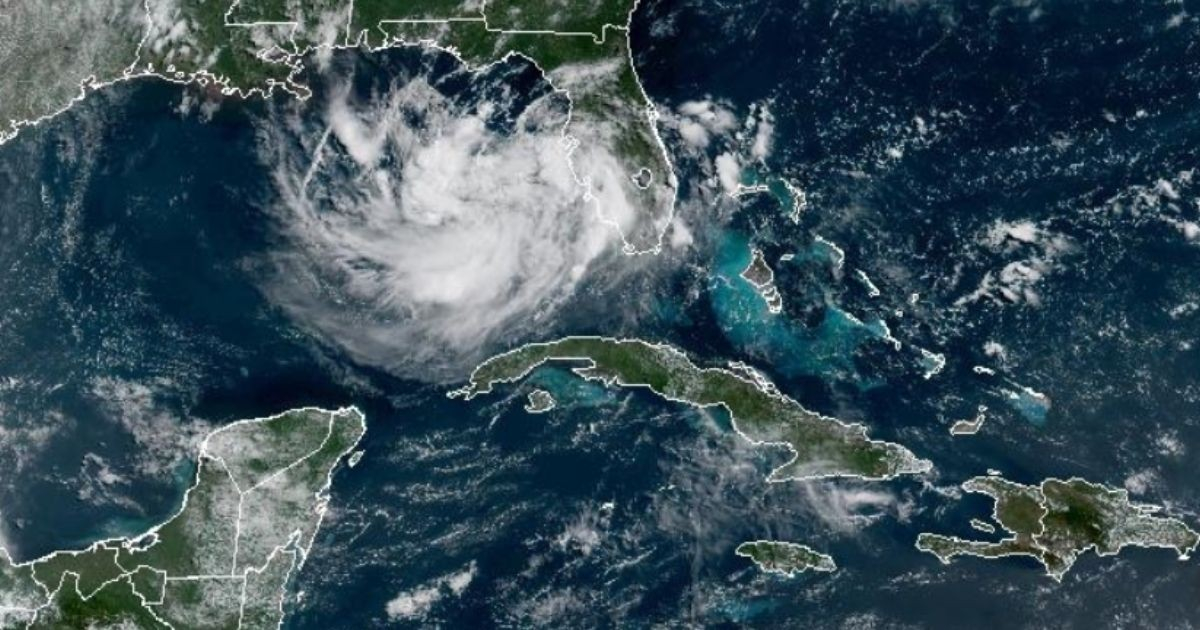
A low-pressure system in the northeastern Gulf of Mexico has put Florida on alert this Saturday. Weather forecasts indicate heavy rainfall and potential flooding throughout the weekend, according to the latest update from the National Hurricane Center (NHC) released this morning.
As of 8:00 AM this Saturday, the NHC issued its Tropical Weather Outlook, giving the system a 20% chance of developing into a tropical cyclone within the next 48 hours, and a 30% chance over the next seven days, both considered "low."
Surface observations have not detected any signs of circulation, and winds in the region remain generally light, which diminishes the likelihood of the system evolving into a named tropical storm.
Nevertheless, meteorologists emphasize that the primary concern is the rainfall, regardless of whether the system is officially named.
Potential Rainfall and Affected Areas
The Tampa Bay area could see rainfall amounts ranging from six to eight inches over the next week, with the heaviest showers expected on Sunday.
The most vulnerable areas include Florida's west coast, the Panhandle, and the Big Bend region, where some locations might experience even greater rainfall accumulations.
Meteorological Insights
Ryan Truchelut, a meteorologist at WeatherTiger, explained that "mid-level moisture is limited, and upper-level winds are marginal. Therefore, whether the system organizes or not, the main impact will be an increase in rain probabilities for Florida and the coastal Southeast."
Truchelut also mentioned that wind shear in the eastern Gulf should remain low until Monday, but is expected to increase again by Tuesday, which would "shut the window for tropical organization."
Should the system develop into a tropical storm, its most likely path would lead it toward the Florida Panhandle or the Big Bend area.
Expert Analysis and Future Outlook
Senior hurricane expert Alex DaSilva from AccuWeather noted that if the system becomes a tropical storm, "it would bring torrential rains to parts of the southeastern United States."
DaSilva further highlighted that this system represents "the best chance for tropical development across the entire Atlantic basin before July ends," although the probability remains low.
Despite this moderate forecast, DaSilva cautioned that "warm waters can allow for rapid intensification, and the forecast can change quickly," urging residents to closely monitor the system's progression over the coming days.
Additionally, the NHC is keeping an eye on two tropical waves in the Atlantic: one moving westward in the eastern Atlantic at about 17 miles per hour, and another moving in the same direction in the central Atlantic at approximately 22 miles per hour.
The Gulf system has been under observation since July 15, when meteorologist Matt Devitt described it as "a rain machine for Florida" with "a lot of tropical moisture on the move."
This development occurs within the context of a 2026 hurricane season that Colorado State University projects to be below the historical average, with only nine named storms, four hurricanes, and one major hurricane expected for the entire season.
Frequently Asked Questions about Florida's Weather Threats
How likely is the Gulf system to develop into a tropical storm?
The National Hurricane Center has given the system a 20% chance of developing into a tropical cyclone within the next 48 hours and a 30% chance within the next seven days, both of which are considered low probabilities.
What areas are most at risk for flooding in Florida?
The regions most at risk include Florida's west coast, the Panhandle, and the Big Bend area, where some locations could experience significant rainfall accumulations.
Why is there concern about rapid intensification?
Warm waters can lead to rapid intensification of tropical systems, which means conditions can change swiftly. This potential for quick development necessitates close monitoring of the system.