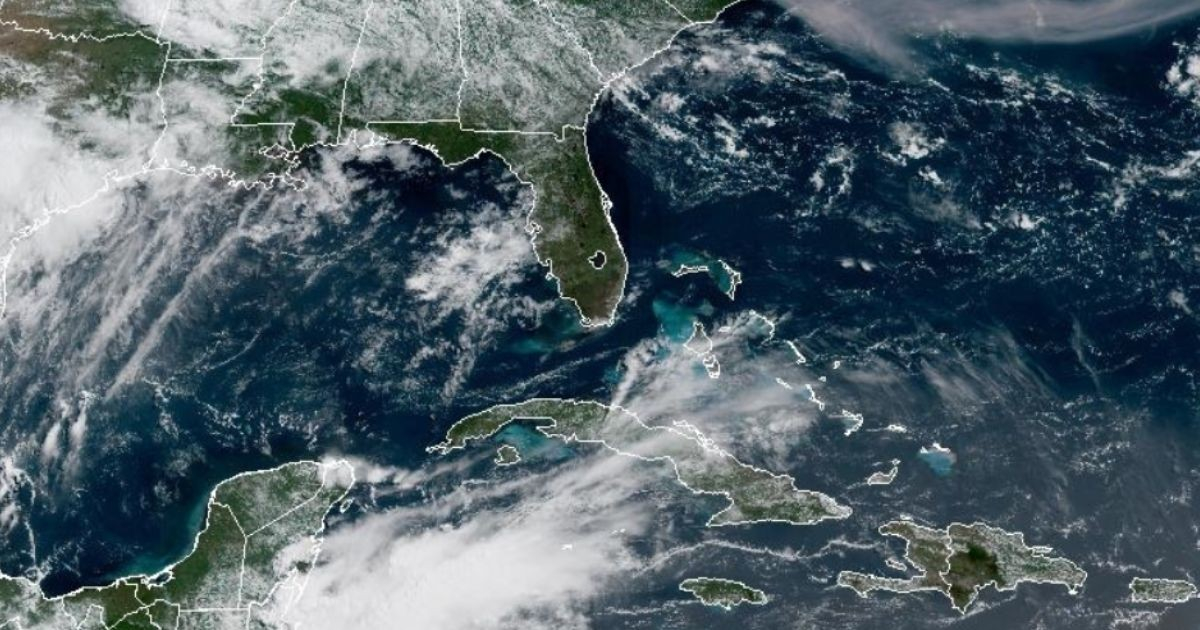
The National Hurricane Center (NHC) in the United States has identified an area of interest in the northeastern Gulf of Mexico, assigning it a 20% chance of developing into an organized tropical system within the next week. This potential development could lead to the season's second named storm: Bertha.
In its Tropical Weather Outlook released at 8:00 AM Eastern Time, the federal agency noted the expected formation of a low-pressure area over the weekend in this region.
According to the NHC, "Gradual development of the system is possible as it moves slowly northeastward over the northeastern Gulf and/or near the southeastern U.S. coast early next week."
The likelihood of formation in the next 48 hours is almost nonexistent—near 0%—but the seven-day outlook stands at 20%, which the agency considers "low."
Meteorologist Matt Devitt, closely monitoring the system via his Facebook page, mentioned that nearly all models shifted overnight, increasing the chances of development. This prompted the NHC to officially mark the area.
"Fluctuations in probabilities are typical in these early stages, which is why we seek consistency," Devitt wrote, adding that the trend was enough for the NHC to act.
Potential Impact on Florida and Beyond
Discussing the most likely impact, Devitt was straightforward: "At a minimum, this will be a rainmaker for Florida. There's a lot of tropical moisture on the move."
Devitt warned that the system's naming as Bertha depends on overcoming wind shear and dry air.
"If it can fight off those factors, it might have a chance over the warmer-than-average waters in the northeastern Gulf. But this is by no means guaranteed," he clarified.
The possible paths of the system remain uncertain among models. Devitt described the situation as "a mess and divided," with two main options: the system moving northeast towards the Carolinas, or turning westward.
Based on the NHC's marked area, the meteorologist believes the agency leans toward a northeastern trajectory.
Timing and Current Forecasts
The potential development is expected to occur over the weekend and into early next week.
Devitt concluded his analysis with a reassuring message: "There's nothing to be alarmed about right now. I'll provide updates around the clock, without exaggeration, just the facts."
The seasonal context is also essential: Colorado State University (CSU) revised its forecast on July 10, predicting only nine named storms, four hurricanes, and one major hurricane, which is 40-45% of the historical average activity.
The NOAA, meanwhile, anticipates between eight and 14 named storms for the entire season.
The first system of the 2026 season was Potential Tropical Cyclone One, which became Tropical Storm Arthur, impacting Texas and Louisiana in mid-June without reaching hurricane status.
If the current system in the Gulf organizes, it would become Bertha, the second storm of the season.
FAQs on Potential Tropical Development in the Gulf
What is the current chance of the system developing into a tropical storm?
The National Hurricane Center has given it a 20% chance of becoming an organized tropical system within the next seven days.
What impact could this system have on Florida?
Meteorologist Matt Devitt states it will likely bring significant rainfall to Florida due to the high amount of tropical moisture.
What factors could prevent the system from developing?
The system needs to overcome wind shear and dry air to have a chance of developing into a named storm.