The Cuban Weather Institute (INSMET) released Tropical Cyclone Warning No. 2 for Tropical Storm Arthur on Wednesday at 6:00 PM. This marks the first named system of the 2026 Atlantic hurricane season.
According to the advisory, Arthur has slightly intensified over the past few hours, boasting maximum sustained winds of 75 kilometers per hour, with even higher gusts, and a minimum pressure of 1001 hectoPascals.
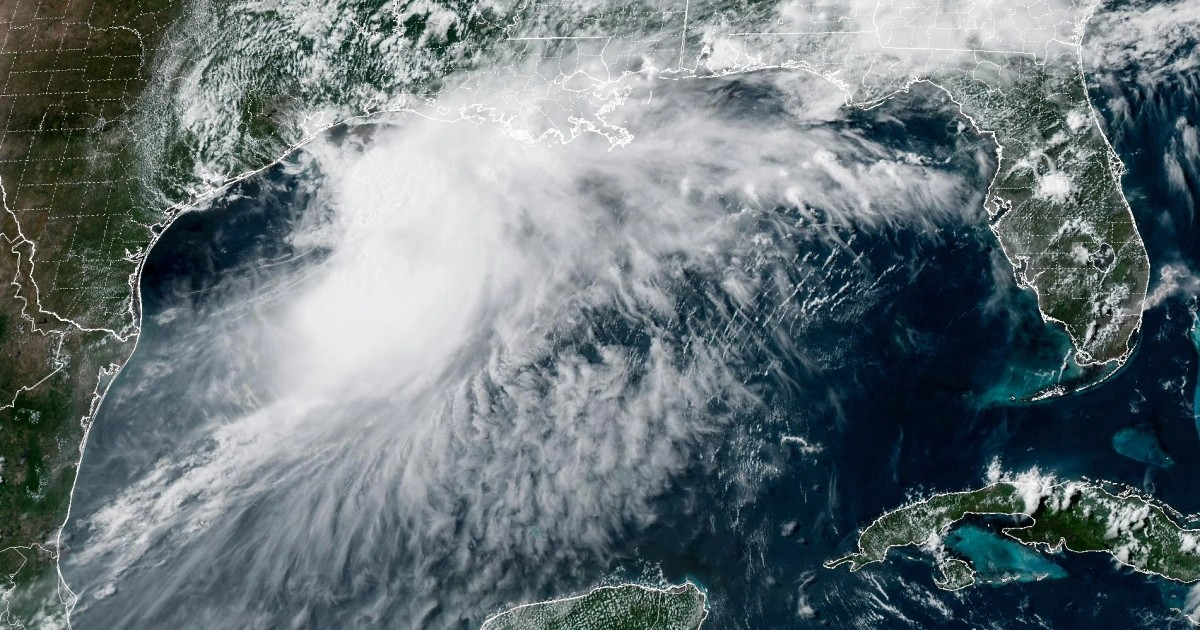
At the time of the advisory, the storm's center was positioned 35 kilometers west-southwest of Matagorda, Texas, at coordinates 28.9 degrees North and 96.1 degrees West, moving northeast at approximately 11 kilometers per hour.
INSMET anticipates Arthur will continue along this path over the next few hours as it travels along the Texas coast, before making landfall near Louisiana and dissipating.
Potential Threats and Projections
The Cuban agency clarified that this would be the final advisory on Arthur, indicating no direct threat to Cuba. Meteorologist José Rubiera emphasized that flooding remains the primary risk from this system: "Rain is the critical factor. Localized flooding poses the greatest danger in terms of the system's impacts."
The U.S. National Hurricane Center (NHC) projected rainfall accumulations ranging from 127 to 254 millimeters, with isolated totals surpassing 500 millimeters in some regions. This has prompted flash flood warnings for Houston's metropolitan area and alerts across Texas, Louisiana, Mississippi, Alabama, Georgia, and Florida's Panhandle.
The NHC also warned of storm surges between two and four feet stretching from Port Bolivar, Texas, to Morgan City, Louisiana, alongside the potential for isolated tornadoes along the Gulf Coast.
Origins and Future of Arthur
Arthur developed from a low-pressure system that crossed land and quickly organized upon encountering the Gulf of Mexico's warm waters, ranging from 30 to 32 degrees Celsius. Rubiera noted that these sea temperatures sparked "convection explosions."
For Cuba, INSMET issued no danger alerts. Rubiera predicted only "some showers, some rain, perhaps a thunderstorm in the central and eastern parts" of the island during the afternoon.
Arthur was officially named by the NHC on Wednesday, becoming the initial storm of the 2026 hurricane season, which commenced on June 1.
INSMET had projected a 40% chance of at least one hurricane affecting Cuba this season and a 75% likelihood of at least one tropical storm impacting the island, within a season expected to be less active than usual due to El Niño's influence.
Rubiera left open the possibility of Arthur regaining strength once it crosses into the Atlantic: "When it reaches the Atlantic, it could be a different story as it will encounter the Gulf Stream, with warm waters also along the eastern U.S. coast, potentially allowing for development."
Key Questions About Tropical Storm Arthur
What is the current status of Tropical Storm Arthur?
Arthur has slightly intensified with sustained winds of 75 kilometers per hour and is moving northeast at 11 kilometers per hour, located 35 kilometers west-southwest of Matagorda, Texas.
Is Tropical Storm Arthur a threat to Cuba?
No, the Cuban Weather Institute has confirmed that Arthur poses no direct threat to Cuba, and this will be their final advisory on the storm.
What are the potential impacts of Arthur in the United States?
The NHC has forecasted heavy rainfall, flash flooding, and storm surges, with potential isolated tornadoes along the Gulf Coast, affecting Texas, Louisiana, Mississippi, Alabama, Georgia, and Florida's Panhandle.
Could Arthur regain strength in the Atlantic?
Yes, once Arthur crosses into the Atlantic, it may encounter the warm Gulf Stream waters, which could lead to further development.