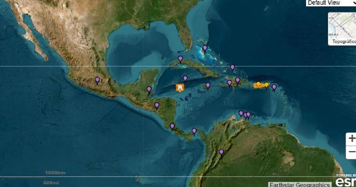
A powerful earthquake with a magnitude of 7.6 struck north of Honduras on Saturday, as reported by the Pacific Tsunami Warning Center (PTWC). The earthquake occurred at a depth of 33 kilometers.
In the wake of the tremor, the PTWC has issued a tsunami warning for several Caribbean regions, including the Cayman Islands, Jamaica, Cuba, Mexico, Honduras, Bahamas, San Andrés and Providencia, Belize, Haiti, Costa Rica, Panama, Nicaragua, and Guatemala.
Experts warn that dangerous waves could impact coastal zones within a 1,000-kilometer radius from the epicenter. Authorities advise staying away from beaches and moving to higher ground as a precautionary measure.
The PTWC has noted that a tsunami consists of a series of waves, with intervals between waves ranging from five minutes to an hour. The threat may continue for several hours after the initial wave.
Authorities are expected to provide updates as more information becomes available. Residents are urged to stay informed through official channels and be prepared for possible evacuations if necessary.
Vulnerable Areas in Cuba
In Cuba, areas most at risk include those along the northern and western coasts, particularly low-lying regions near the sea. Some of the most vulnerable locations are:
Santiago de Cuba – Situated on the southeastern coast, this area is one of the most exposed to seismic events and tsunamis in the Caribbean.
Guantánamo (Baracoa) – The coastal city of Baracoa in Guantánamo Province has faced similar events in the past.
Holguín (Gibara and Banes) – This northeastern province contains several low-altitude coastal towns.
Camagüey (Santa Cruz del Sur) – Known for historical marine events, such as the devastating 1932 hurricane that caused a massive storm surge.
Havana – While not at the epicenter of risk, its northern coastal location makes it susceptible to potential sea level changes.
Matanzas (Varadero and Matanzas Bay) – Its northern coastal position and low-lying areas could experience minor impacts.
Ciego de Ávila (Cayo Coco and Cayo Guillermo) – The tourist zones of the Jardines del Rey archipelago are vulnerable due to their proximity to the sea.
Safety Measures
Stay informed through local authorities and the Cuban Meteorological Institute.
Evacuate to higher ground if official alerts are issued.
Avoid beaches and coastal areas until the warning is lifted.
Cuban authorities are closely monitoring the situation and may issue additional recommendations as the situation evolves.
Frequently Asked Questions About the Tsunami Threat
What areas are included in the tsunami warning?
The tsunami warning includes multiple regions in the Caribbean such as the Cayman Islands, Jamaica, Cuba, Mexico, Honduras, Bahamas, San Andrés and Providencia, Belize, Haiti, Costa Rica, Panama, Nicaragua, and Guatemala.
How long could the tsunami threat last?
The tsunami threat could persist for several hours after the first wave, as it consists of a series of waves with varying intervals between them.
What safety precautions should be taken?
Individuals should stay informed through official channels, evacuate to higher ground if necessary, and avoid beaches and coastal areas until the warning is lifted.