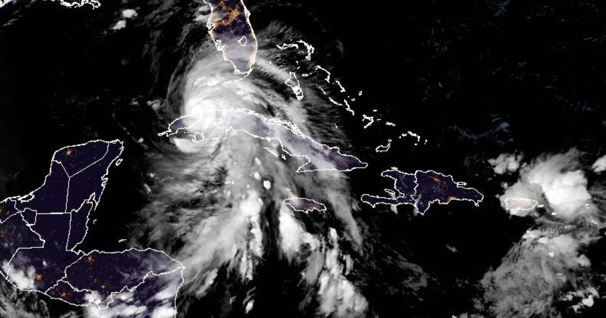
After making landfall at Playa Majana south of Artemisa as a Category 3 storm, Hurricane Rafael has weakened, now packing sustained winds of 175 km/h, which classifies it as a Category 2 hurricane. It is anticipated to move back out to sea between the provinces of Pinar del Río and Artemisa.
Cuban meteorologist Raydel Ruisánchez shared on Facebook that the hurricane will continue its northwest trajectory over Artemisa, traveling at a speed of 22 km/h. It is expected to exit the landmass between Bahía Honda and La Mulata between 7:00 p.m. and 8:00 p.m. this Wednesday. "Its effects, though diminishing, will persist through the night and early morning," the expert noted.
Additionally, the Mariel weather station recorded sustained winds of 130 km/h with a maximum gust reaching 174 km/h. In a subsequent update, Ruisánchez explained that "part of Rafael's center is now moving off the northern coast of Artemisa, near Bahía Honda. Strong winds will continue to impact the province overnight, albeit to a lesser extent," he indicated.
Havana Feels the Impact
In Havana, Hurricane Rafael unleashed hurricane-force winds across various parts of the Cuban capital, as reported on social media platforms. This situation had been previously warned by renowned Cuban meteorologist José Rubiera, who, during the midday broadcast of the national news, highlighted the significant hazards posed by the hurricane.
"Expect strong, intense rains as the hurricane tracks northwest towards Pinar del Río," Dr. Rubiera stated. He also cautioned about the potential for hurricane-force winds, storm surges, coastal flooding, and sea level rise—known as storm surge—which will lead to a storm tide.
Rubiera emphasized that a hurricane "is not just a point but a large area," explaining that the rain associated with this meteorological phenomenon "can extend to central Cuba and beyond with its spiral bands," and that storm surges can affect a broad region as well.
