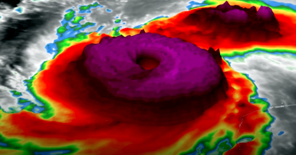
The formidable Hurricane Milton has achieved a Category 5 status, packing sustained winds of 180 miles per hour. Its barometric pressure has plummeted to 897 millibars (mb), ranking it as the fifth lowest pressure hurricane ever recorded in the Western Hemisphere. This places Milton among the most powerful hurricanes historically, nearing the theoretical intensity limits of such storms, according to a study by MIT. As reported by Telemundo Chicago, Milton is "nearly at the limit of what Earth's atmosphere can produce."
According to The Weather Channel, Milton is now the fifth strongest hurricane observed in the Atlantic basin, trailing behind Wilma (2005, at 882 mb), Gilbert (1988, at 888 mb), Labor Day (1935, at 892 mb), and Rita (2005, at 895 mb). Meteorologist Noah Bergren expressed his astonishment over Milton's magnitude on social media. "This is nothing short of astronomical. I am at a loss for words to meteorologically describe the storm's small eye and its intensity," he commented on X. "A pressure of 897 mb with maximum sustained winds of 180 MPH and gusts exceeding 200 MPH. This is now the fifth strongest hurricane ever recorded by pressure on this side of the world. The eye is small, nearly 3.8 miles across. This hurricane is approaching the mathematical limit of what Earth's atmosphere can produce," he added.
Threatening Florida: Evacuations and Preparations Underway
The looming threat of Milton over Florida has prompted evacuations and widespread preparations in anticipation of potential storm surges and severe flooding. The National Hurricane Center (NHC) has warned that Milton is a "potentially catastrophic" hurricane. Although some fluctuations in intensity are expected before landfall, it remains extremely dangerous.
Hurricane-force winds could impact areas up to 30 miles from the storm's center, while tropical storm-force winds might extend up to 80 miles. A storm surge of up to 15 feet is forecasted along Florida's coast, particularly in Tampa Bay. Additionally, Milton is expected to bring 5 to 10 inches of rain in central Florida, with localized accumulations reaching 15 inches, leading to significant flooding in some areas.
The Making of a "Monster"
The effects of the hurricane could start to be felt in Florida by Wednesday afternoon, with Milton potentially making landfall overnight, impacting millions in its path. The hurricane has rapidly intensified over recent days, reaching Category 5 status on Monday, with winds sustained at up to 250 km/h.
Data from the National Hurricane Center indicate that Milton became a dangerous Category 5 hurricane as it advanced towards Florida's west coast, causing great concern among officials and residents. Its trajectory placed it near the Yucatán Peninsula, with the possibility of making landfall in Florida in the coming days.
On Tuesday, meteorologist John Morales, known for his composure during extreme situations, was visibly moved while reporting live on Milton's intensification. His emotional response underscored the seriousness of the situation, as winds reached 250 km/h and evacuation orders were issued for Florida's most vulnerable areas. Authorities stressed the importance of heeding evacuation orders and taking necessary measures to safeguard lives and property.
Milton sustains winds of up to 250 km/h, posing a serious threat to Florida, where storm surges, torrential rains, and destructive winds are anticipated. The National Hurricane Center's warnings urge the public to complete their preparations before the hurricane's arrival, which could result in extensive damage.
