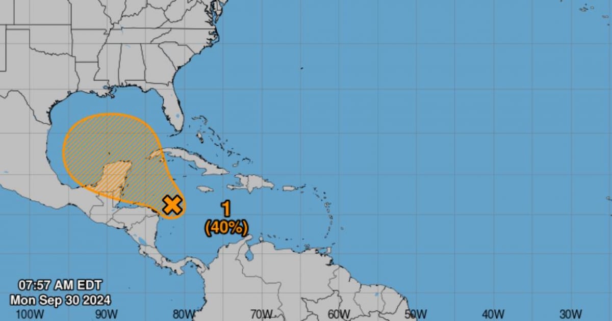
The National Hurricane Center (NHC) announced this morning that they are keeping an eye on a broad low-pressure area in the western Caribbean, the same spot where Hurricane Helene originated, impacting Cuba, Mexico, and primarily Florida last week.
At the moment, this low-pressure area is disorganized, but environmental conditions might become more conducive for its development over the next few days, increasing the chances of it evolving into a tropical depression by the end of the week.
The NHC noted that although the associated rain and thunderstorms currently show no signs of organization, the low-pressure zone could gradually strengthen as it moves northwest, potentially reaching the southern Gulf of Mexico or the northwestern Caribbean Sea.
Formation probabilities are low within the next 48 hours but rise to 40% over the next seven days.
Active Systems in the Atlantic
The NHC is also issuing advisories on Tropical Storm Isaac, located several hundred miles north of the Azores, and on Tropical Depression Joyce.
Additionally, Tropical Storm Kirk has formed, and there is another area under surveillance in the eastern Atlantic.
Forecast and Recommendations
Tropical Storm Kirk is positioned near latitude 13.5 North, longitude 34.8 West, moving westward at approximately 12 mph (19 km/h). This movement is expected to continue through Tuesday, with a gradual turn toward the northwest anticipated by Wednesday.
Meteorologists advise that individuals in the northwestern Caribbean Sea and along the U.S. Gulf Coast closely monitor the development of these systems. While it may take several days for them to develop, conditions could become favorable for the formation of a tropical cyclone by the weekend.
