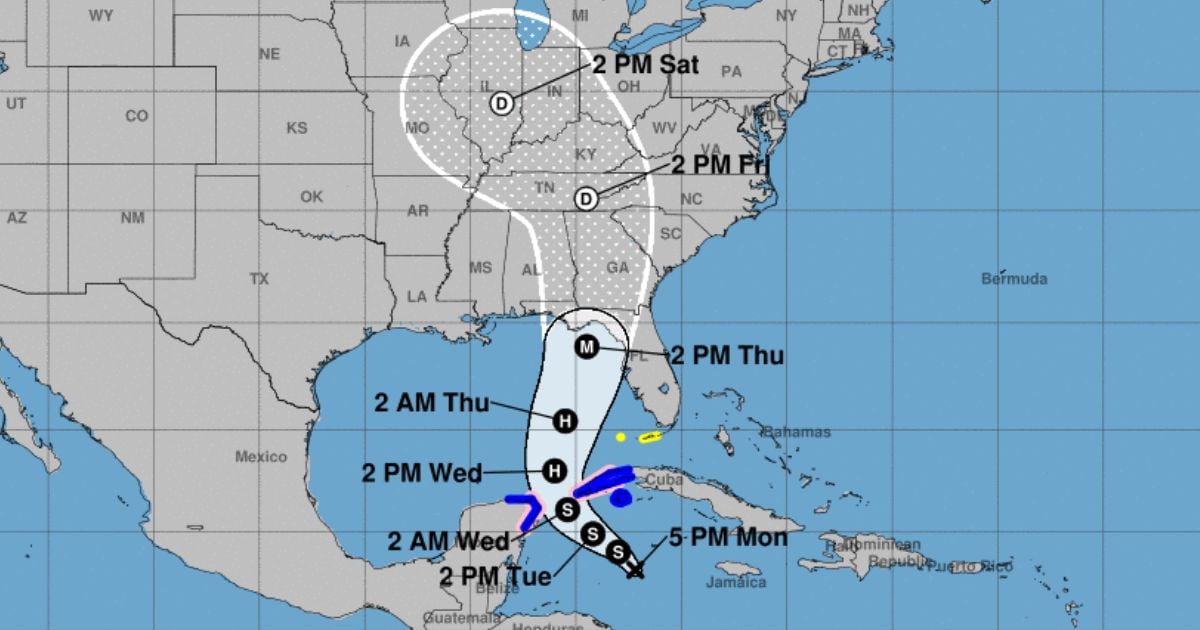
The National Hurricane Center (NHC) announced on Monday that Potential Cyclone Nine is expected to intensify into a major hurricane, named Helene, before making landfall on the northeast Gulf Coast of Florida this Thursday.
The NHC's latest advisory warns that the system will bring dangerously high storm surges and destructive winds, primarily impacting Florida's panhandle and the state's west coast. Hurricane and storm surge warnings are anticipated to be issued late Monday or early Tuesday for certain areas in the region, as the risk of severe impacts grows, according to the NHC.
Residents in these areas are urged to prepare and activate their hurricane mitigation plans, as the storm, to be named Helene, approaches. The NHC has also forecasted heavy rainfall affecting the western Caribbean, potentially causing floods and landslides in western Cuba.
Meanwhile, the Cuban Institute of Meteorology (INSMET) issued an early warning on Monday for intense rainfall in the western part of the country. This is due to the potential tropical cyclone forming in the northwest Caribbean Sea, where a broad area of low pressure has become better organized over the past 12 hours, bringing with it extensive cloudiness, showers, and thunderstorms.
The Forecast Center of Pinar del Río reported that from Tuesday to Thursday, rainfall amounts are expected to range between 150 and 200 mm across most of the province, potentially exceeding 300 mm in the westernmost areas.
Cuban meteorologist Raydel Ruisanchez shared the potential cyclone's trajectory on Facebook, highlighting the threat it poses to Pinar del Río. "Tropical storm force winds are expected from Pinar del Río to Artemisa, including the Isla de la Juventud, with hurricane-force winds possible in the far western regions," the meteorologist stated.
"Strong storm surges are expected along the southern coast of western Cuba, including Isla de la Juventud," Ruisanchez added.
